UNIFIL Maps Nearly 30 Israeli Positions Across South Lebanon
UNIFIL says nearly 30 Israeli positions, including eight fortified bases at sites such as Khiam and Maroun El Ras, now sit inside southern Lebanon.
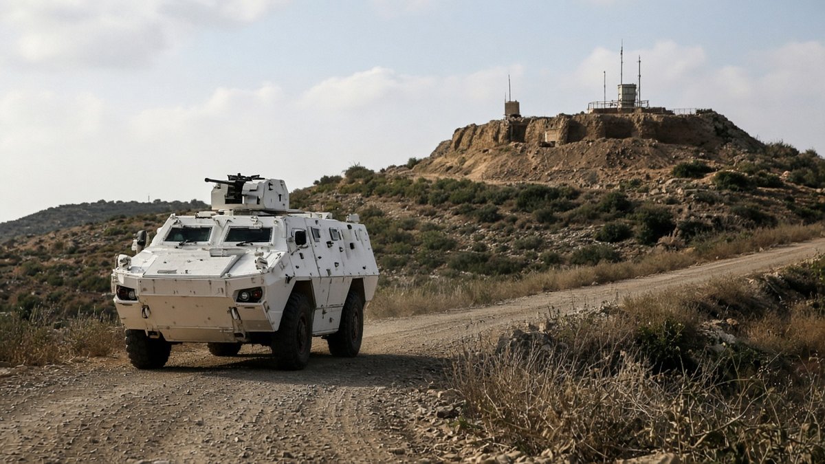
BEIRUT / SOUTH LEBANON — September 22, 2026. Nearly thirty Israeli positions now sit inside southern Lebanon, including eight fortified bases and about twenty ad hoc sites, with three new fortified bases established at Khiam, Maroun El Ras and Maiss El Jabal after the March escalation that followed the assassination of Iran’s Supreme Leader Ayatollah Ali Khamenei, UNIFIL spokeswoman Kandice Ardiel told The National in a September 22 account that maps a occupation footprint expanding well beyond earlier buffer assumptions.
Ardiel’s briefing describes an Israeli zone reaching up to ten kilometers into Lebanese territory and a “yellow line” that keeps shifting as engineering and patrol patterns change. The three named fortified bases after March mark a qualitative step from temporary fighting positions to hardened infrastructure — concrete, logistics and permanence signals that local mayors and the Lebanese Armed Forces read as occupation architecture rather than fleeting raids. Roughly twenty ad hoc positions fill the gaps, creating a lattice of control that complicates civilian return, farming and any monitoring regime UNIFIL is mandated to support.
Incidents last week underline how that lattice collides with Lebanese state presence. Israeli forces used stun grenades at a Lebanese Armed Forces checkpoint in Deir Mimas, according to the same reporting. Separately, the mayor of Kfarshouba was detained — a civilian-authority shock that sends a message to municipal leaders across the border villages. UNIFIL’s public inventory of positions and bases is therefore not only a counting exercise; it is a warning that the monitoring force sees fortification and harassment patterns settling in.
How the Israeli Footprint Grew After March
The March trigger matters for timelines. After Khamenei’s assassination, fighting surged and Israeli engineering pushed farther north of the Blue Line. Summer frameworks and diplomatic language about withdrawal or limited presence have not matched Ardiel’s nearly-thirty-position map. Hezbollah’s residual networks, Lebanese Army deployment constraints and Israeli insistence on residual security control produce a three-way stalemate in which UNIFIL documents facts on the ground that politicians prefer to blur. A shifting yellow line is the cartographic expression of that stalemate.
Tuesday’s UNIFIL-sourced account is about inventory: eight fortified bases, three post-March additions at Khiam, Maroun El Ras and Maiss El Jabal, roughly twenty ad hoc sites, a zone up to ten kilometers deep, stun grenades at an LAF checkpoint and a mayor’s detention.
Civilians in the southern villages experience the inventory as closed roads, delayed returns and municipal fear after the Kfarshouba detention. Farmers cannot treat a shifting yellow line as a temporary inconvenience when fortified bases at Khiam, Maroun El Ras and Maiss El Jabal look built to last. Lebanese domestic politics — army capacity, Hezbollah’s residual role, cabinet fragility — limits how hard Beirut can push beyond filing complaints and amplifying UNIFIL’s count. That domestic constraint is part of why Ardiel’s public map matters: international documentation fills a gap national power cannot.
What Ardiel’s numbers measure is permanence risk. Nearly thirty positions and eight fortified bases are not a raid footprint; they are a structure that can outlast any single ceasefire communiqué. For Beirut, the map is evidence to take to the United Nations and Arab mediators. For Israel, the bases are insurance against Hezbollah reconstitution. For UNIFIL, counting aloud is the remaining tool when enforcement levers are thin. Until the yellow line stops moving and fortified construction pauses, southern Lebanon will be read not as a buffer in transition but as a militarized belt whose depth is measured in kilometers, concrete and detained mayors.
Sources
- The National: UNIFIL counts eight fortified bases among 30 Israeli military positions in south Lebanon
- VOI: Israel has 30 military positions in southern Lebanon, eight of which are reinforced

One Comment